
Stop Losing Hours to Paperwork After Every Site Visit
Capture photos, measure from satellite, annotate issues, and generate professional reports. All from one app. No more scattered photos or handwritten notes.
Capture & Report in One Trip
Document the full site without going back
Measure from Satellite
Areas, distances, and perimeters from your desk
Share Instantly
PDF reports and live links, no files to email
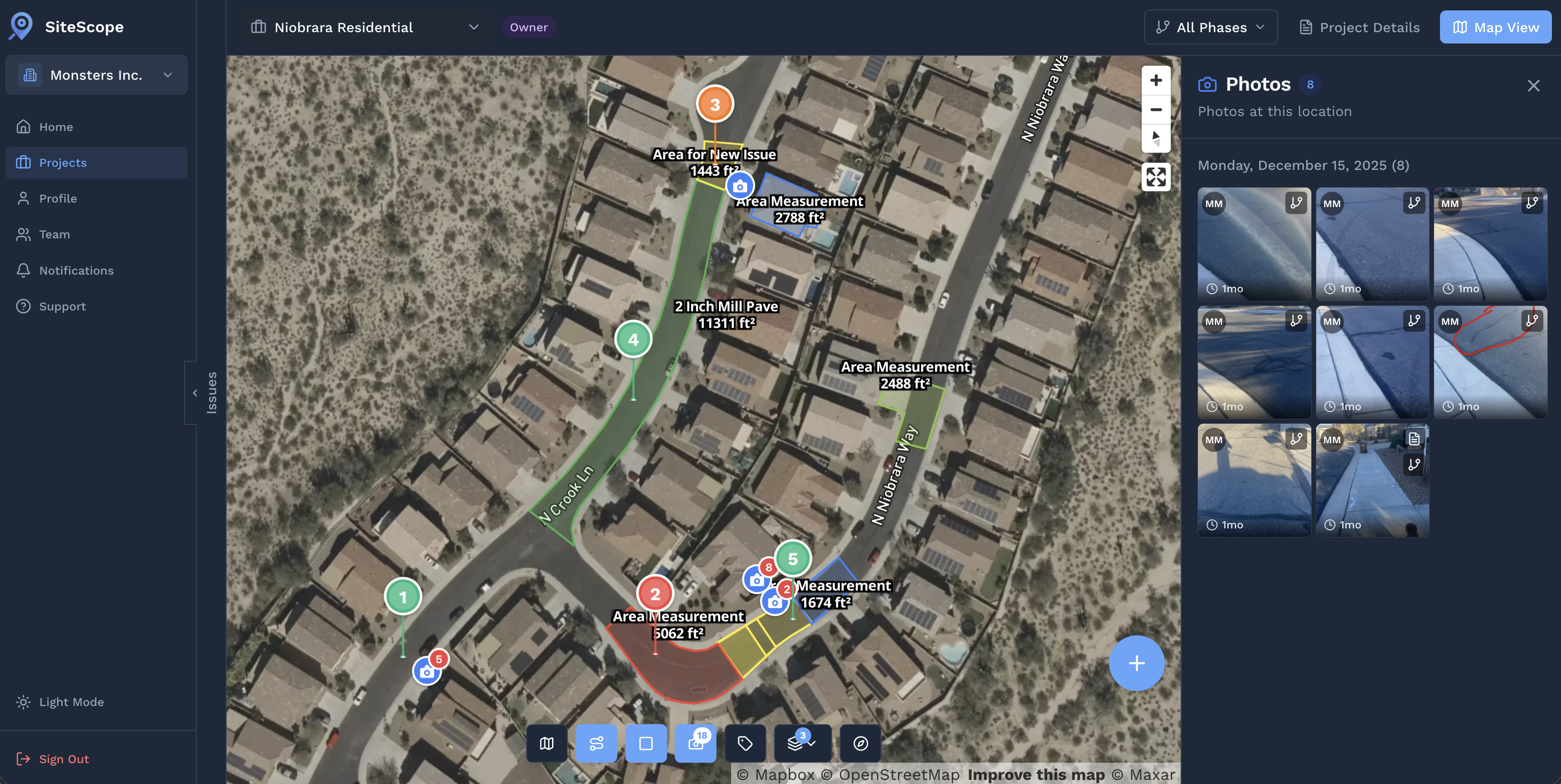
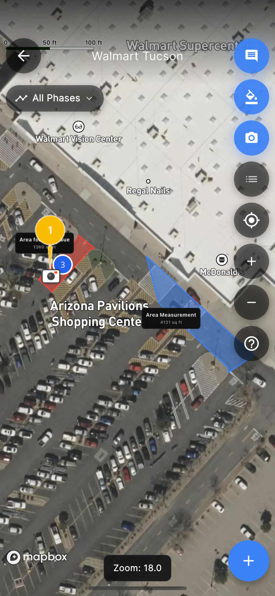
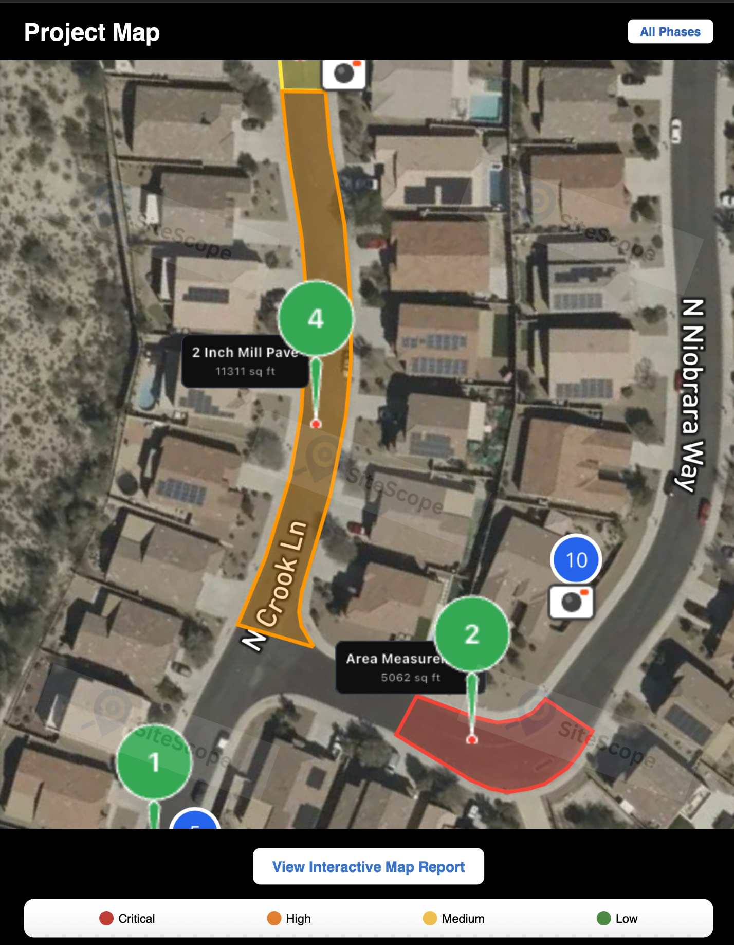
Measure Any Site Without Setting Foot on It
Trace roofs, lots, and driveways on a satellite map to get areas, distances, and perimeters. Perfect for estimates before you even leave the office.
- Measure roofs, lots, and structures from satellite imagery
- Get square footage, linear feet, and perimeters instantly
- Build accurate bids without a site visit
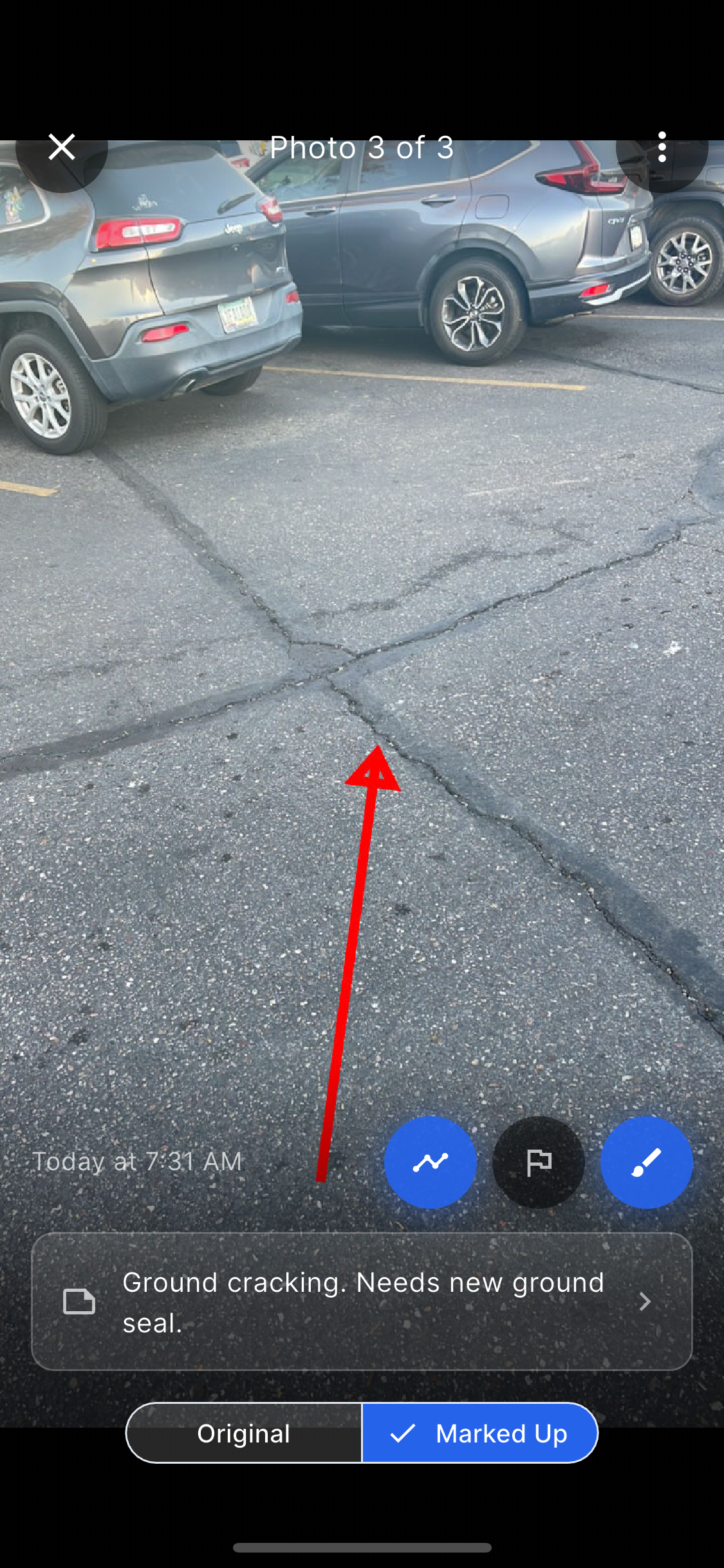
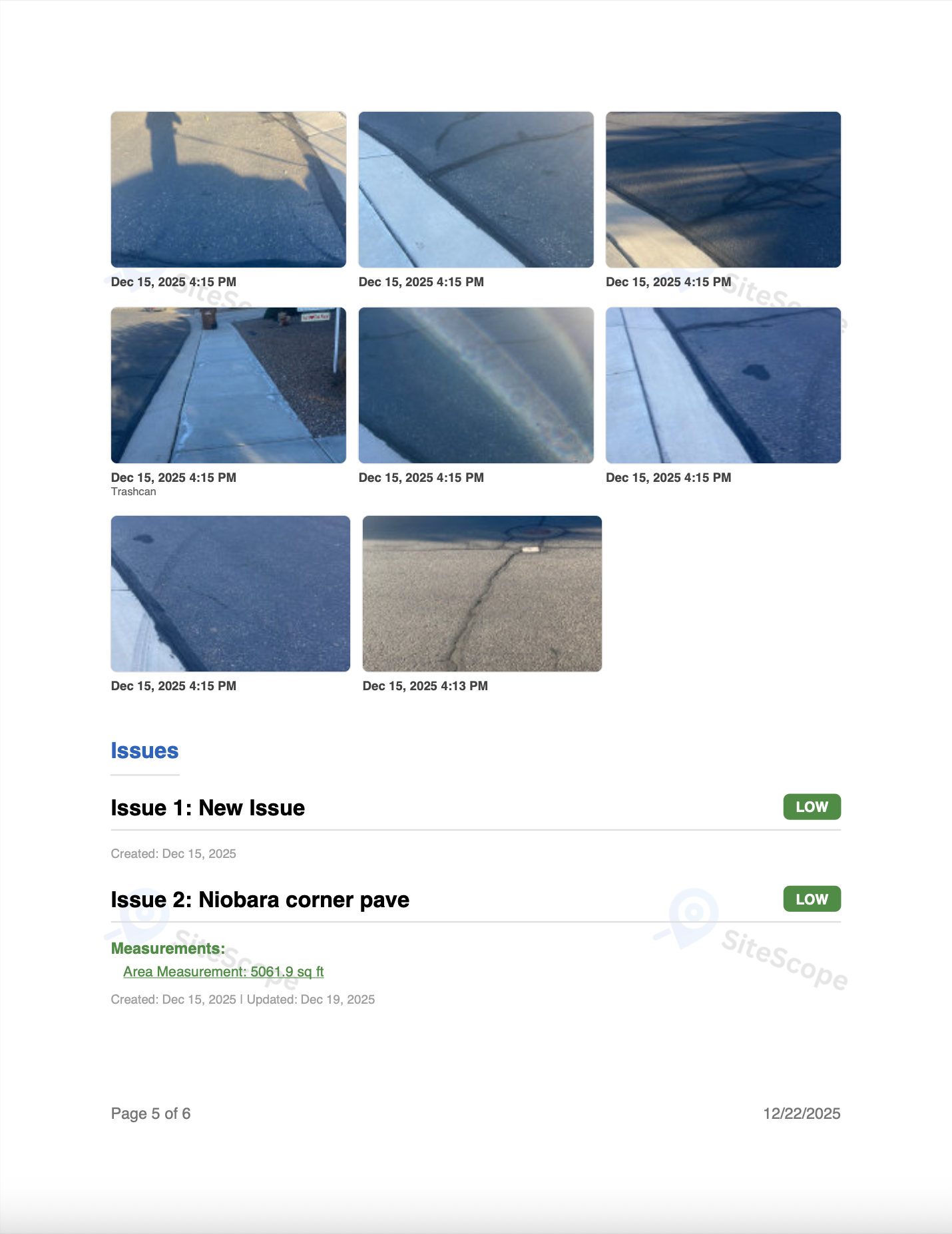
Document Issues the Moment You See Them
Take geotagged photos, mark them up with annotations, and organize everything by project, right from the field.
- GPS-tagged photos with timestamps for every shot
- Draw arrows, circles, and text directly on photos
- Organize photos by project, issue, or location
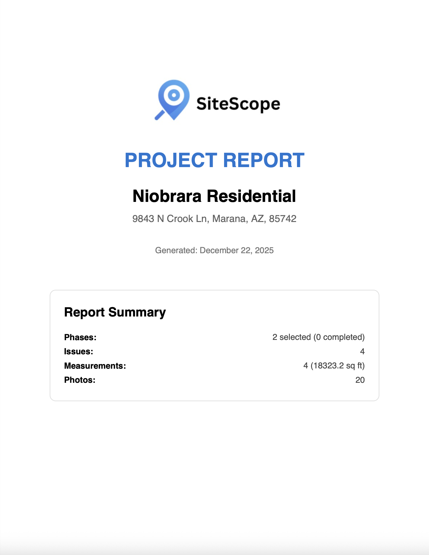
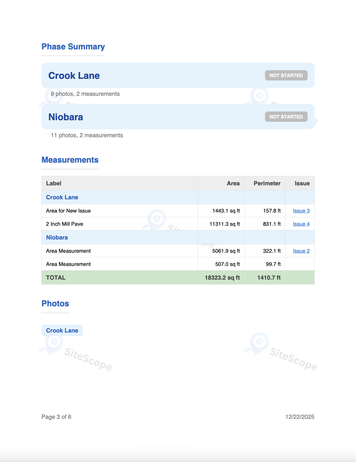
Generate Reports Your Clients Actually Read
One tap generates a polished PDF with photos, maps, measurements, and issue details. Or share a live link. No attachments needed.
- Professional PDF reports generated in seconds
- Shareable live links with optional password protection
- Maps, photos, and measurements included automatically
See the Full Workflow
Capture on your phone in the field, then review and share from the web. Everything stays in sync.
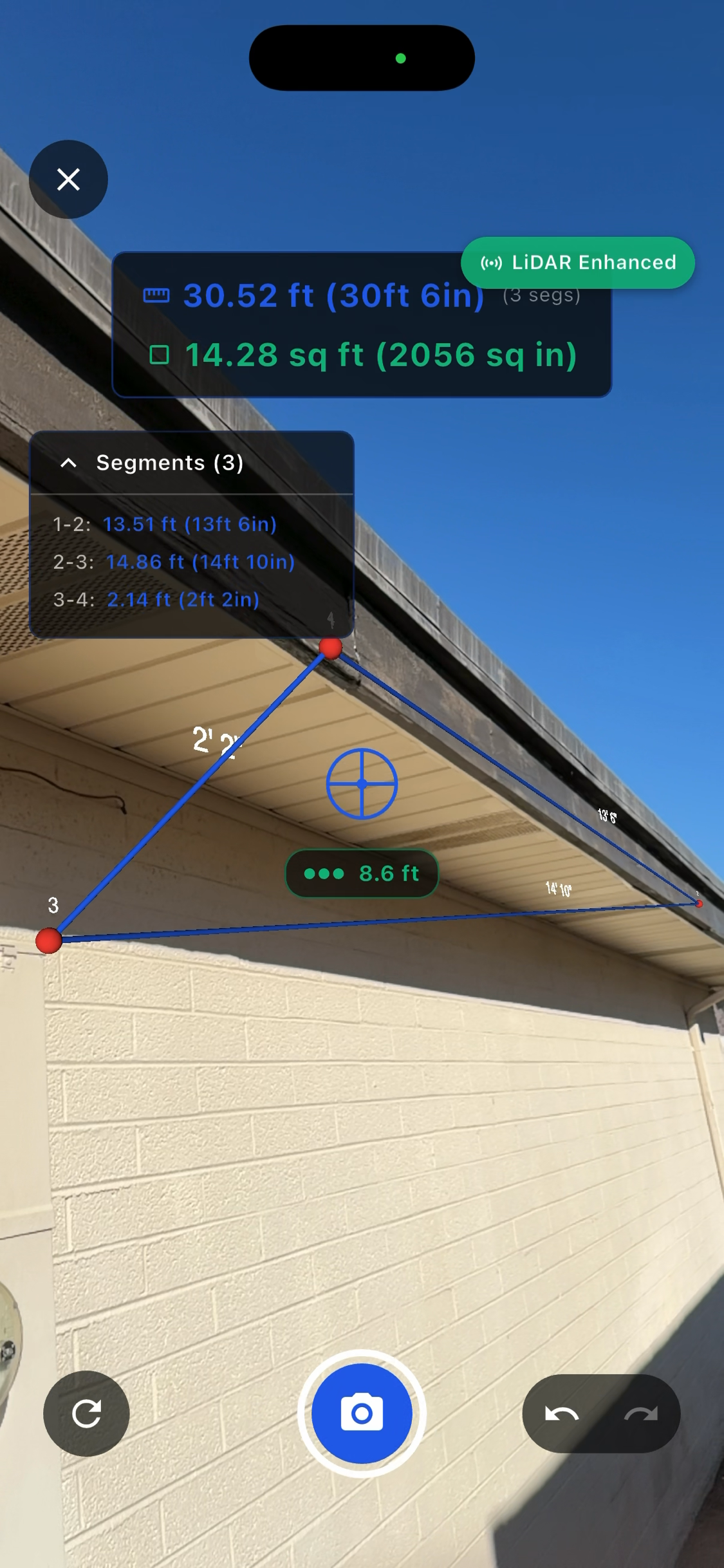
Capture on Mobile
Photos, satellite measurements, and AR tools, all in one app.
Review & Share on Web
Everything syncs to the web. Review photos, check measurements, generate PDF reports, and share live links with clients.
Don't Want to Visit the Site?
You don't always need to be on-site. Here are two ways to get what you need from your desk.
Measure from Satellite
Trace roofs, lots, and driveways on a satellite map. Get square footage, perimeter, and linear measurements, all without leaving your desk.
Send a Team Member
Invite anyone on your team to capture photos and document issues on-site. Everything syncs to your account automatically. You review from anywhere.
Who Uses SiteScope Exterior
Trusted by professionals who work outside every day.

Construction
Document progress, track issues, and keep every stakeholder in the loop.
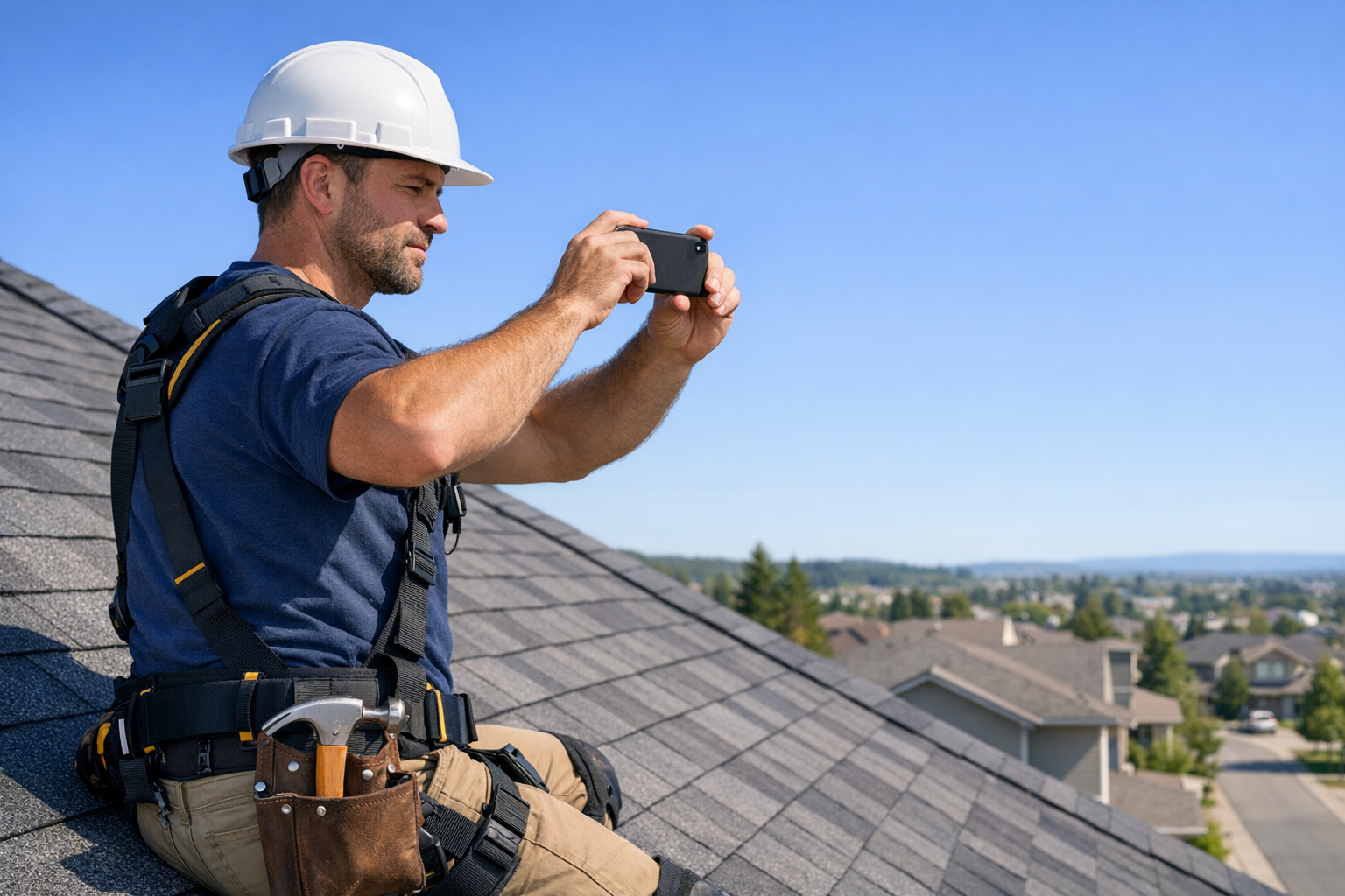
Roofing
Measure roofs from satellite and document damage without climbing.
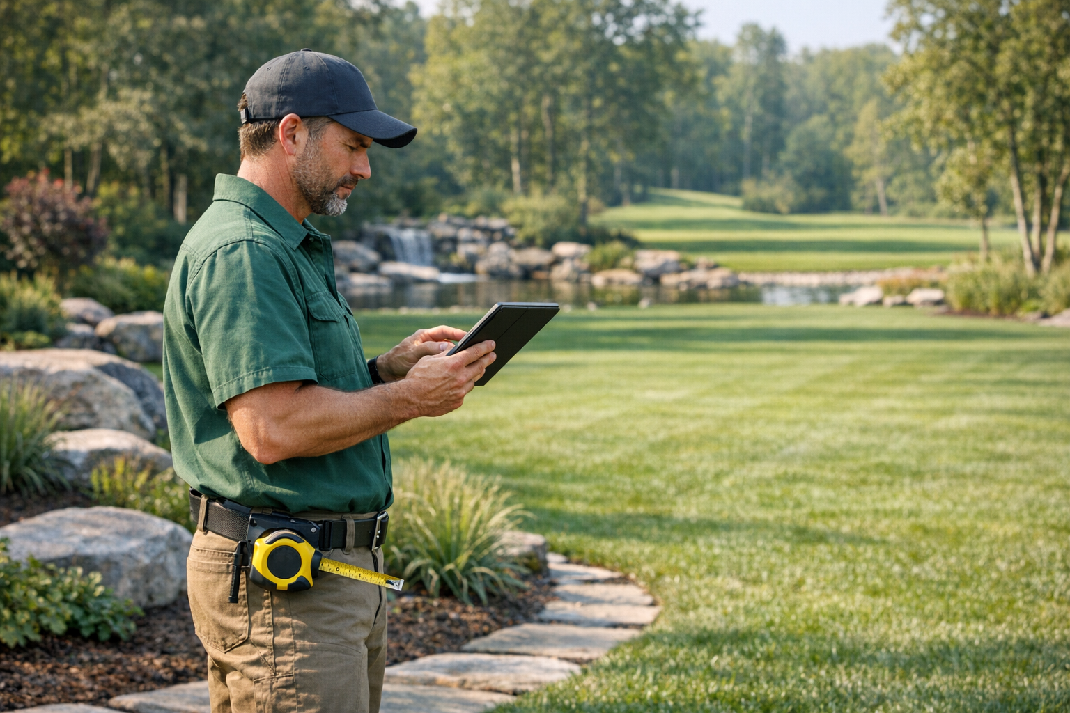
Landscaping
Measure lots, plan layouts, and share proposals with clients.
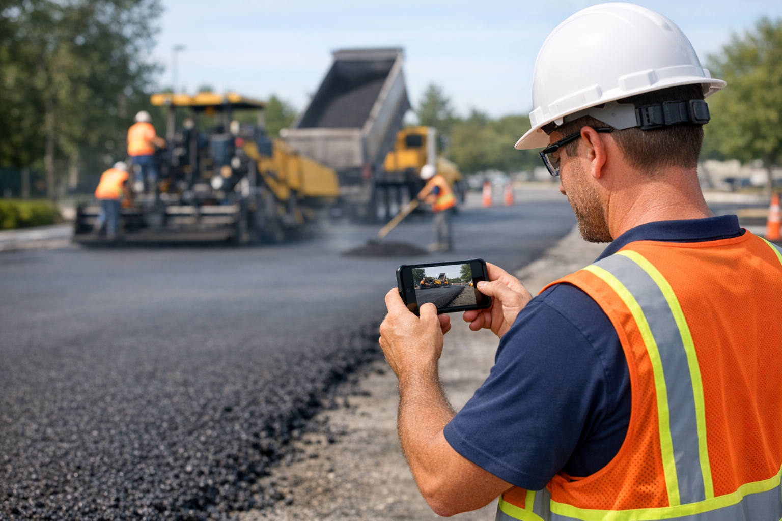
Asphalt & Paving
Calculate square footage from satellite for accurate bids.
Estimating
Accurate site measurements for confident bids, interior and exterior.
Get Started in Minutes
Download the mobile app to capture in the field. Sign up on the web to review, measure from satellite, and share reports.
Sign Up Free