
Accurate Estimates Start with Better Site Data
Capture precise measurements, document existing conditions, and create comprehensive site surveys. SiteScope gives estimators the data they need to bid with confidence.
Challenges We Solve for Estimators
Inaccurate Site Measurements
Use satellite mapping and AR tools to capture precise measurements. No more guessing or return trips.
Missing Site Details
Capture comprehensive photos with annotations. Document everything you need for accurate takeoffs.
Multiple Site Visits
Get it right the first time. Pre-measure from satellite, then verify on-site with a complete checklist.
Features Built for Estimators
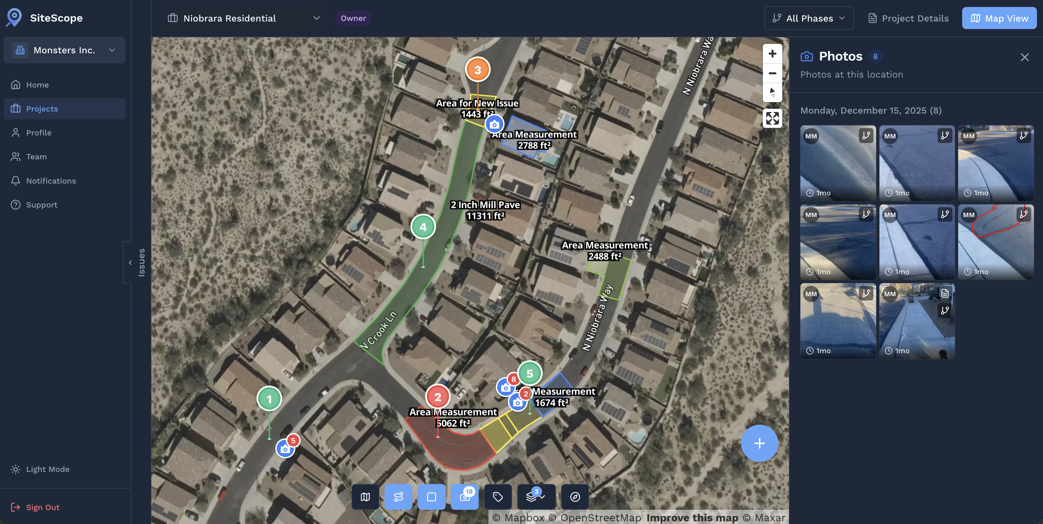
Satellite Measurements
Measure areas and distances from satellite imagery before you even arrive on site.
Interior Material Takeoffs
Scan a room, assign materials to walls and regions, and get wall-by-wall quantities with openings deducted, automatically. See how takeoffs work →
Photo Documentation
Capture site conditions with timestamped, geotagged photos. Annotate to highlight key details.
Professional Reports
Generate PDF reports with all measurements, photos, and notes for your estimate files.
Streamline Your Estimating Workflow
Pre-Survey
Measure from satellite before the site visit
Document
Capture photos and verify measurements on-site
Calculate
Get automatic area and quantity calculations
Export
Generate reports for your estimate file
Win More Bids with Professional Documentation
Stand out from the competition with comprehensive site surveys and polished proposals
Demonstrates Thoroughness
Comprehensive documentation shows you've done your homework on the project.
Professional Presentation
Clean, organized reports make your company look professional and trustworthy.
Accurate Pricing
Precise measurements lead to accurate bids that protect your margins.
Interior Jobs? Get Quantities from the Floor Plan.
For interior projects, documentation and takeoffs are the same workflow, scan once, get both.
- Wall-by-wall quantities: net paintable or finish area computed automatically, with doors and windows deducted.
- Assign your own materials and unit costs: set cost, charge, and target margin per material. Quantities update live as you refine the drawing.
- CSV export drops straight into your existing estimate template, no re-keying.
Related Use Cases
See how other professionals use SiteScope
Ready to Get Started?
Join professionals who are already mapping and measuring their sites with SiteScope.