
As-Built Documentation, Captured On Site
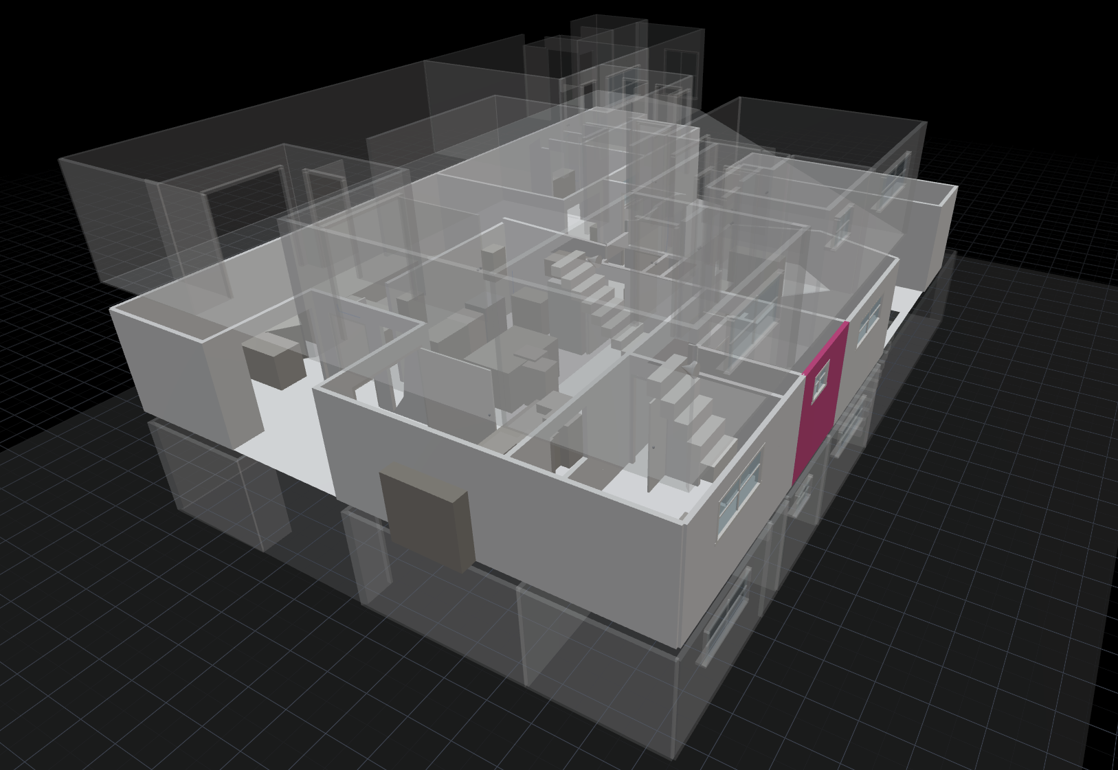
Scan existing conditions with LiDAR and walk away with a measured, editable floor plan. Generate a construction document set with schedules, export layered DXF to AutoCAD or Revit, and mark up the drawings for coordination. Measure once, draft once.
The Existing-Conditions Problem
Hand-Measuring Is Slow and Risky
Tape-measuring an existing building eats hours and still misses things. A LiDAR scan captures every wall, opening, and ceiling height in minutes, with dimensions you can trust.
Drafting the Same Thing Twice
Measure on site, then redraw it all in CAD back at the desk. SiteScope turns the scan into editable geometry that exports straight to DXF, so you draft once.
Schedules Drift From Drawings
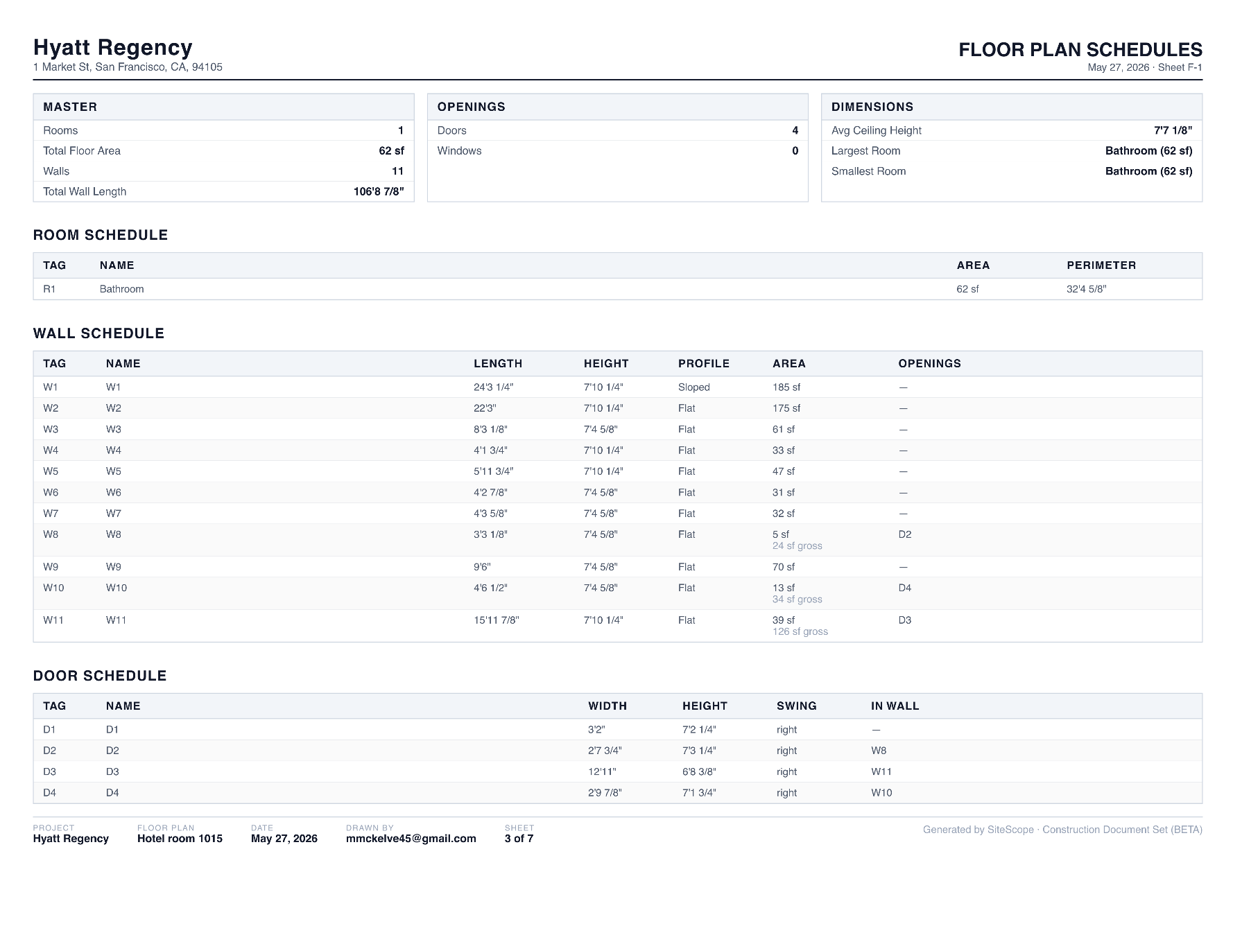
Hand-maintained schedules fall out of sync with the plan. SiteScope generates Room, Wall, Door, and Window schedules from the geometry, so they always match.
Schedules Generated From the Plan
Room, Wall, Door, and Window schedules plus a master summary, in feet-inches or metric. Net areas deduct openings and trim, and every element is tagged to match the drawing.
Built for Documentation and Handoff
3D Scan to Measured Plan*
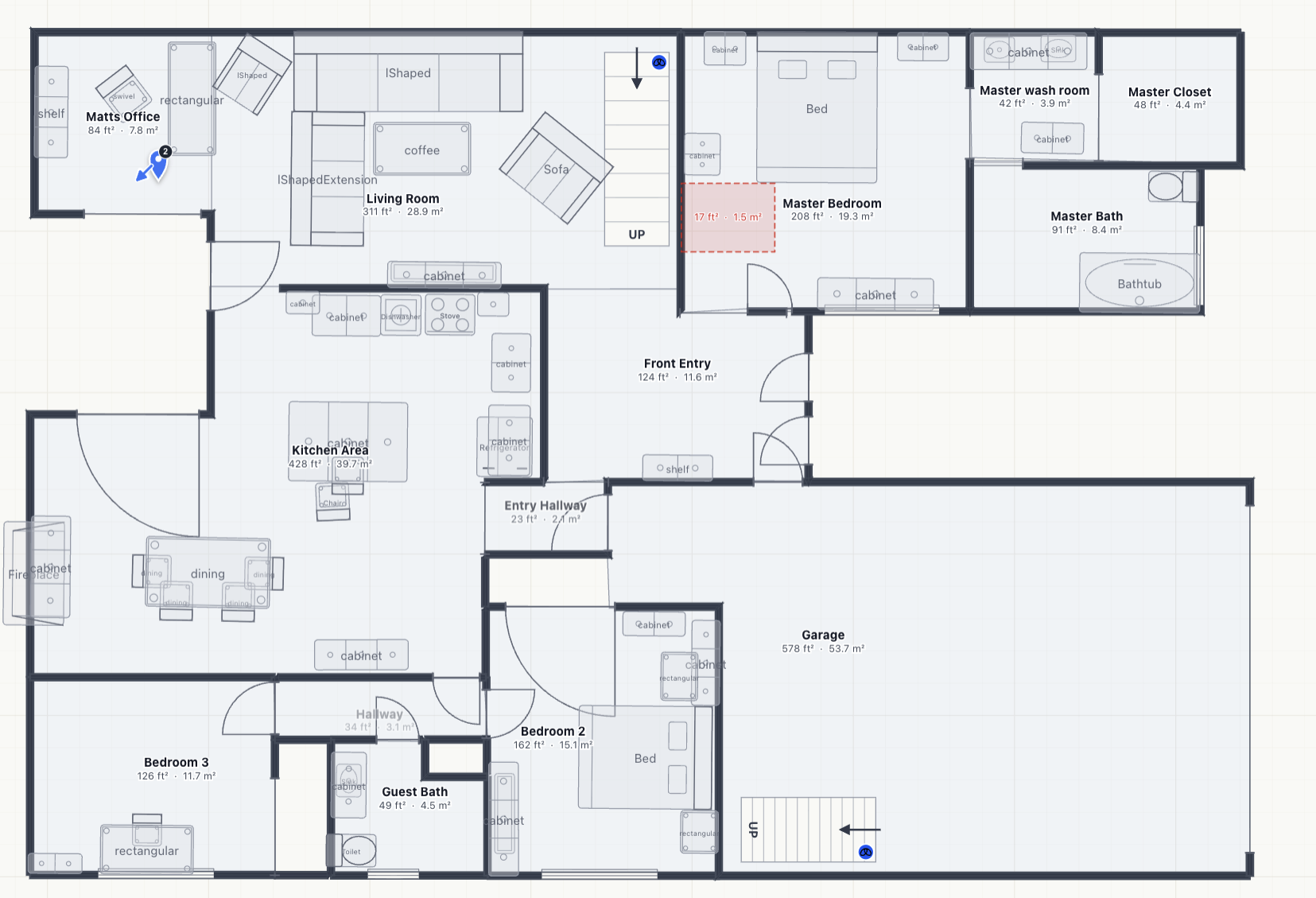
Capture existing conditions with iPhone or iPad Pro LiDAR. Every wall length, height, and opening is measured automatically. Learn more →
IFC, DXF + GLB Export
Export IFC for Revit and ArchiCAD, layered DXF for AutoCAD, GLB for 3D, and PDF for the document set. The same geometry drives every format.
Editable Geometry
Trace, adjust walls, add doors and windows, and label rooms in the editor. Refine the as-built before it goes into your document set.
PDF Markup for Redlines
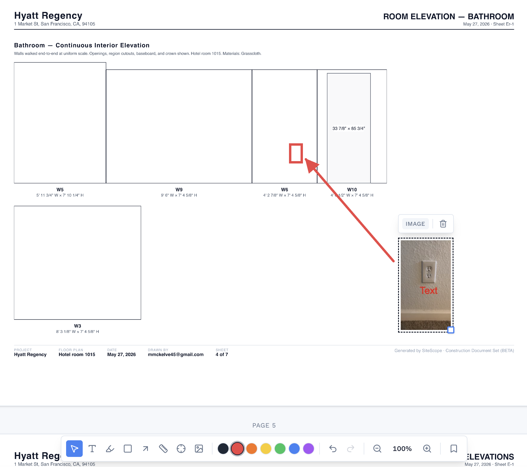
Add photos, arrows, and text callouts on any page for coordination and redlines, then export the marked-up set.
* 3D room scanning requires iPhone 12 Pro or later, or iPad Pro (2020 or later) with LiDAR sensor
Existing Conditions, Straight Into Revit
Export IFC, the open BIM exchange format, and open the scanned building in Revit, ArchiCAD, or any IFC-aware tool, with walls, doors, windows, rooms, and multiple stories intact. Skip the manual re-modeling and start design from an accurate as-built.
- IFC export opens in Revit, ArchiCAD, and Navisworks
- Walls, doors, windows, rooms, and multiple stories come across as objects, not a mesh
- A starting model for renovation and retrofit, not another day of re-drawing
Mark Up the Set Before Handoff
Drop in photos, draw call-outs on a wall elevation, and add notes where the geometry needs context. No round-trip through a separate annotation tool.
Related Use Cases
See how the document set connects to the rest of the workflow
Frequently Asked Questions
How does SiteScope help architects with existing conditions?
Can I export to AutoCAD or Revit?
What schedules are included in the document set?
Can I redline or mark up the drawings?
Ready to Get Started?
Join professionals who are already mapping and measuring their sites with SiteScope.