
A photoreal 3D walkthrough from your iPhone. Walk the site again, no second trip.
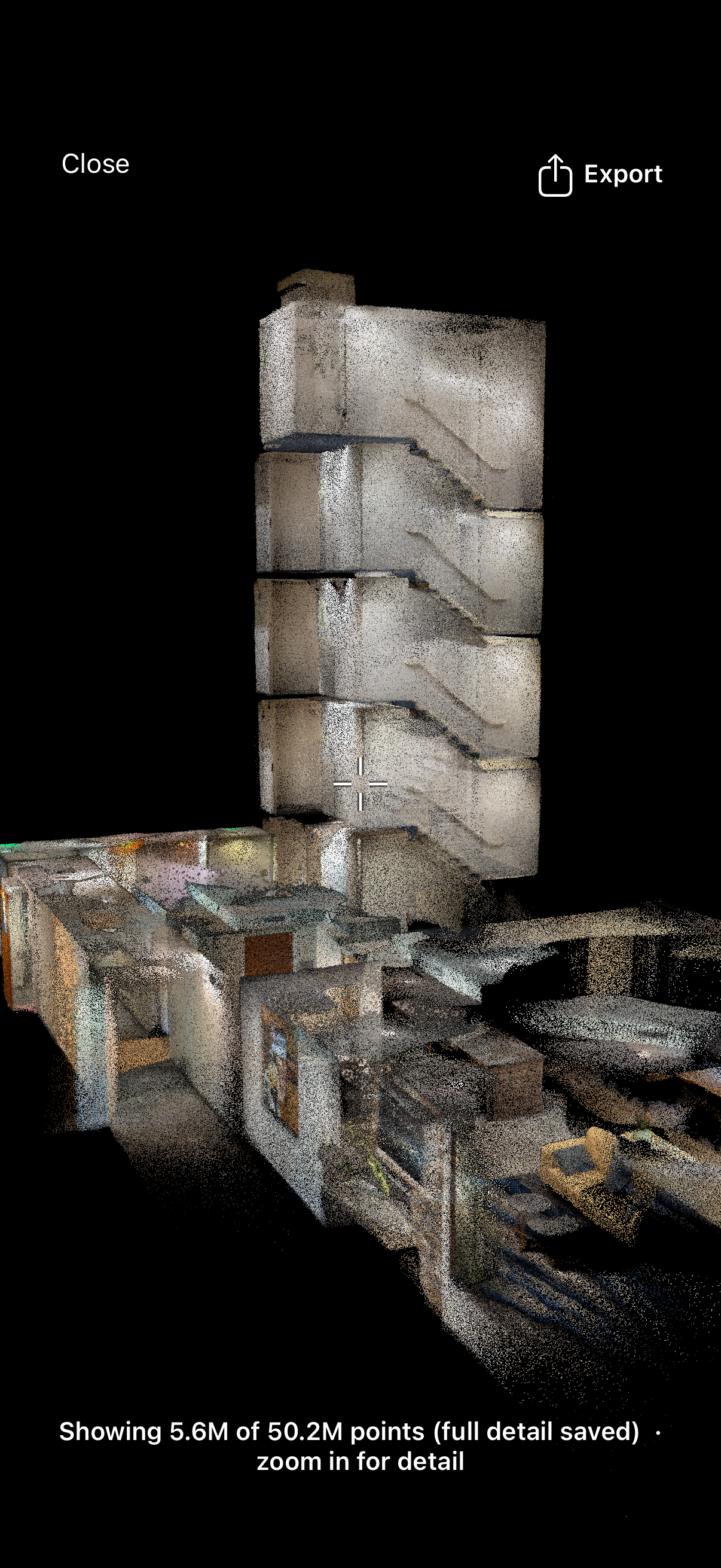
Capture a space with an iPhone Pro and get a photoreal 3D walkthrough of the real site, plus a measured E57 point cloud, from the same single scan. Tag locations with notes and photos, then share a link that opens in any browser. One visit, and your whole team can walk the space from their desk, anytime, with nothing to install.
The walkthrough, plus the point cloud
Matterport built the category, and a Matterport space is a great walkthrough. The difference is what you walk away with. SiteScope captures with the iPhone Pro you already carry, and one scan gives you both a photoreal walkthrough and a measured point cloud you own.
| Capability | SiteScope | Matterport |
|---|---|---|
| Capture hardware | iPhone or iPad Pro you already own | iPhone app, 360 cameras, or Matterport Pro cameras |
| Photoreal 3D walkthrough | ✓ | ✓ |
| E57 point cloud from an iPhone scan | E57 into ReCap and Revit | E57 is a paid add-on that needs a Matterport Pro camera capture |
| Tag locations with notes and photos in 3D | ✓ | ✓ |
| Open file exports | E57 / LAZ / PLY, plus IFC / DXF / GLB / PDF from room scans | Mostly paid add-ons |
| Share by link, nothing for the client to install | ✓ | ✓ |
Comparison based on publicly documented features as of Sept 2026. Verify current capabilities with each vendor. We compare on capability and ownership, not price.
A photoreal walkthrough and a measured point cloud, from one scan.
Walk the space once with an iPhone Pro. You get the photoreal walkthrough for seeing and communicating the site, and a dense, measured point cloud for the numbers. The point cloud exports to E57, so the same capture that your client walks through also drops into Autodesk ReCap and Revit. Stop driving back to the job site to check a dimension or a condition.
- Photoreal walkthrough to see and share the real space, in the browser, no app for the client.
- Measured E57 point cloud for ReCap, Revit, and the scan-to-BIM stack, not just a mesh.
- The site, captured once, open to your whole team forever, no second trip.
Tag locations in the space
Pin notes and photos to exact spots in the walkthrough. A condition, a spec, a punch item, or a reference shot sits where it belongs, anchored in 3D, so everyone reads the same thing in the same place.
Notes that stay put
Drop a note on the exact wall, fixture, or corner it refers to. No more describing which room, which side, which outlet. The tag is right there in the space.
Photos in context
Anchor a reference photo to the spot it documents, so a detail reads in place instead of living in a camera roll no one can match to the room.
One source for the team
Share the link and the crew, the client, and the consultant all see the same tags in the same locations. The site, captured once, open to everyone, same day.
Honest about the hardware and the accuracy
Capture needs an iPhone Pro or iPad Pro. The Pro models carry the LiDAR sensor the scan relies on, so that is the one requirement, and we will not pretend a non-Pro phone does it. The upside is that it is a device you may already own, not a dedicated camera you buy or rent.
The photoreal walkthrough is built for seeing and communicating the space. Precise measurement lives in the companion E57 point cloud from the same capture. That cloud is centimeter-class: room-scale captures typically land within a couple of centimeters over a normal room, which is the right band for documentation, space planning, and coordination. It is not a survey-grade terrestrial scanner, and we do not claim it is.
Treat the scan the way you treat any field survey. Verify code-driven and fabrication-driven dimensions, long runs, and glass against a tape or laser before you build on them. The step that disappears is the second trip to the site, not your judgment.
See the measured exports for architectsWhere the walkthrough fits
One scan feeds the walkthrough, the point cloud, and the whole documentation workflow
For Architects
Existing-conditions documentation with E57, IFC, and DXF exports
Digital Twin
A measured point cloud you can orbit, measure, and slice in the browser
Scan to BIM
Turn the scan into a structured IFC model for Revit and ArchiCAD
3D Room Scanning
Capture existing conditions in 3D from your iPhone or iPad Pro
Frequently Asked Questions
How is this different from Matterport?
What do I need to capture one?
Can I share it without an account?
Can I measure in it?
Do I get a point cloud and an E57 too?
What is location tagging?
Ready to Get Started?
Scan your first room free, no credit card. Capture runs on an iPhone or iPad Pro, and everything else works in your browser.

On your computer?
Point your iPhone camera here to get the free app from the App Store. Scanning needs an iPhone or iPad Pro.