
Existing conditions, documented the same day.
Plenty of older buildings have no usable drawings. Scan the space with iPhone LiDAR and walk away with a dense point cloud, a viewer you can share by link, and exports in the formats your stack already reads: E57 into ReCap and Revit, IFC for ArchiCAD, layered DXF, and a dimensioned PDF set. No terrestrial scanner, no service bureau, no two-week wait.
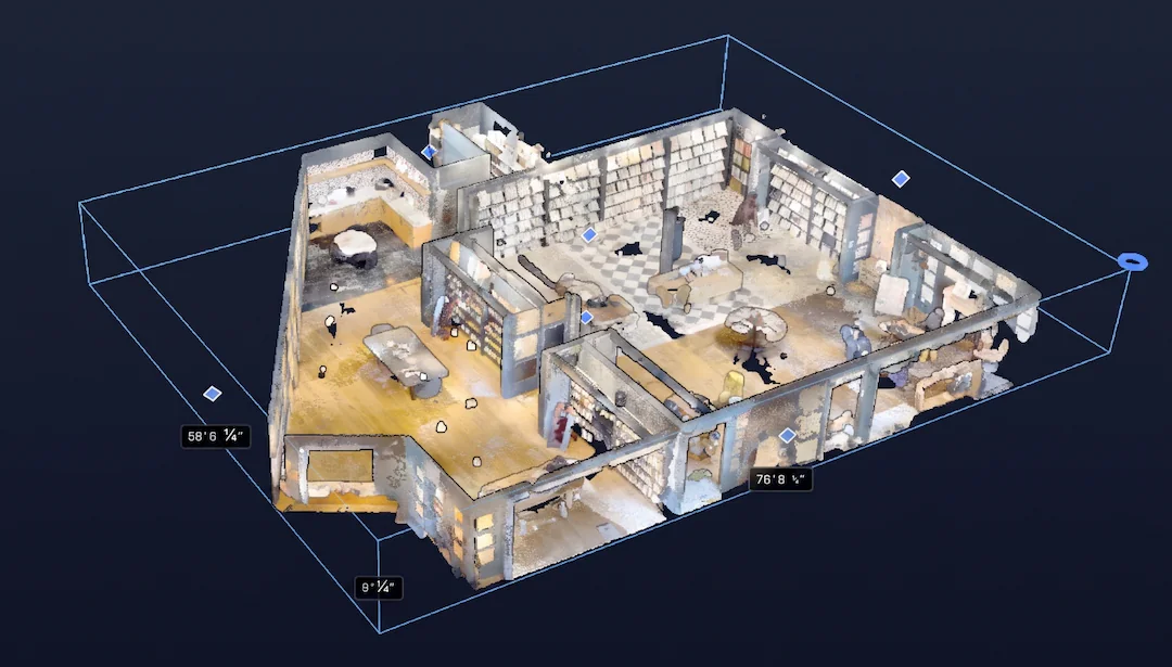
One iPhone LiDAR scan, captured as a dense, measured point cloud. Share it in the browser, no app to install.
The existing-conditions problem
Renovation and adaptive-reuse work starts with documenting what is already there. The old options are slow, expensive, or both.
No drawings to start from
Most pre-1990 buildings have no usable record set. Hand-measuring an existing structure eats hours and still misses things. A LiDAR scan captures every wall, opening, and ceiling height in minutes.
Service bureaus are slow and pricey
Hiring a scan-to-BIM service means booking a crew and waiting on a model. An iPhone scan is same day, and the cloud, the viewer, and the exports are yours to keep.
Handoff formats never match
One consultant wants E57 for ReCap, another wants IFC for ArchiCAD, the trades want a DXF underlay. SiteScope exports all of them from the same measured capture, so nobody re-keys geometry.
Send the scan, not a giant download.
The measured point cloud opens in any browser from a single share link. This is the working tool your consultants actually use. They orbit the space, pull real dimensions straight off the cloud, and cut plan-style slices themselves. No account, no software, no waiting on a 2 GB file. Progressive streaming keeps even a whole-building scan fast.
- Measure with level and plumb locks. Hold Shift to lock a run level, Option to lock a plumb height like floor-to-floor, so the number you read is the number that matters.
- Slice the building for plan-style cuts. Crop with a draggable box, read live feet-inches dimensions, rotate to square with the walls, and set a height band for clean sections through any level.
- Verify dimensions against the cloud. Check long runs, openings, and ceiling heights right in the browser before anyone builds design work on the import.
- Optional password and expiry. Gate the link for clients and consultants when the project calls for it.
Need the visual, experiential version to walk a client through? That is the photoreal walkthrough, the companion for visual review. This viewer is where the measuring gets done.
Every format your consultants already receive
The point cloud, the model, and the drawing set all come out of one capture. Hand each collaborator the format their tool reads, with no re-keying and no drift between them.
E57
Point cloudThe scanner-industry exchange format. Drop it into Autodesk ReCap to bring the cloud into Revit, or into an ArchiCAD or Vectorworks workflow.
LAZ / COPC
Point cloudCompressed point cloud in the LAS family, cloud-optimized so a large scan streams instead of downloading whole. Opens in the tools that read LAS and LAZ.
PLY
Point cloudThe raw points, unprocessed, for the pipelines and research tools that want the cloud as captured.
IFC
BIM modelThe open BIM model. Walls, doors, windows, rooms, and multiple stories come across as real objects for Revit and ArchiCAD, not a mesh to trace.
DXF
CADA layered CAD underlay to trace over in AutoCAD, aligned to the same measured geometry as every other export.
GLB
3D modelA 3D model that opens in native viewers, macOS Quick Look and the Windows 3D viewer, with nothing to install.
A dimensioned drawing set with Room, Wall, Door, and Window schedules generated from the plan geometry.
One capture, seven ways out.
You capture once. The scan feeds the cloud, the BIM model, the CAD underlay, and the PDF set, so the numbers agree across every file.
Walk the site again from your desk, from the same scan.
One capture gives you both: a photoreal 3D walkthrough of the real space to see and share, and the measured E57 point cloud your stack runs on. Send a link and a client or consultant walks the building in the browser with nothing to install, while you export the cloud for ReCap and Revit. One visit, and the site stays open to your whole team, no second trip to check a condition.
- Photoreal walkthrough for review and coordination, in any browser
- A measured E57 point cloud from the same iPhone scan
- Tag locations with notes and photos anchored in 3D
Centimeter-class, and honest about it
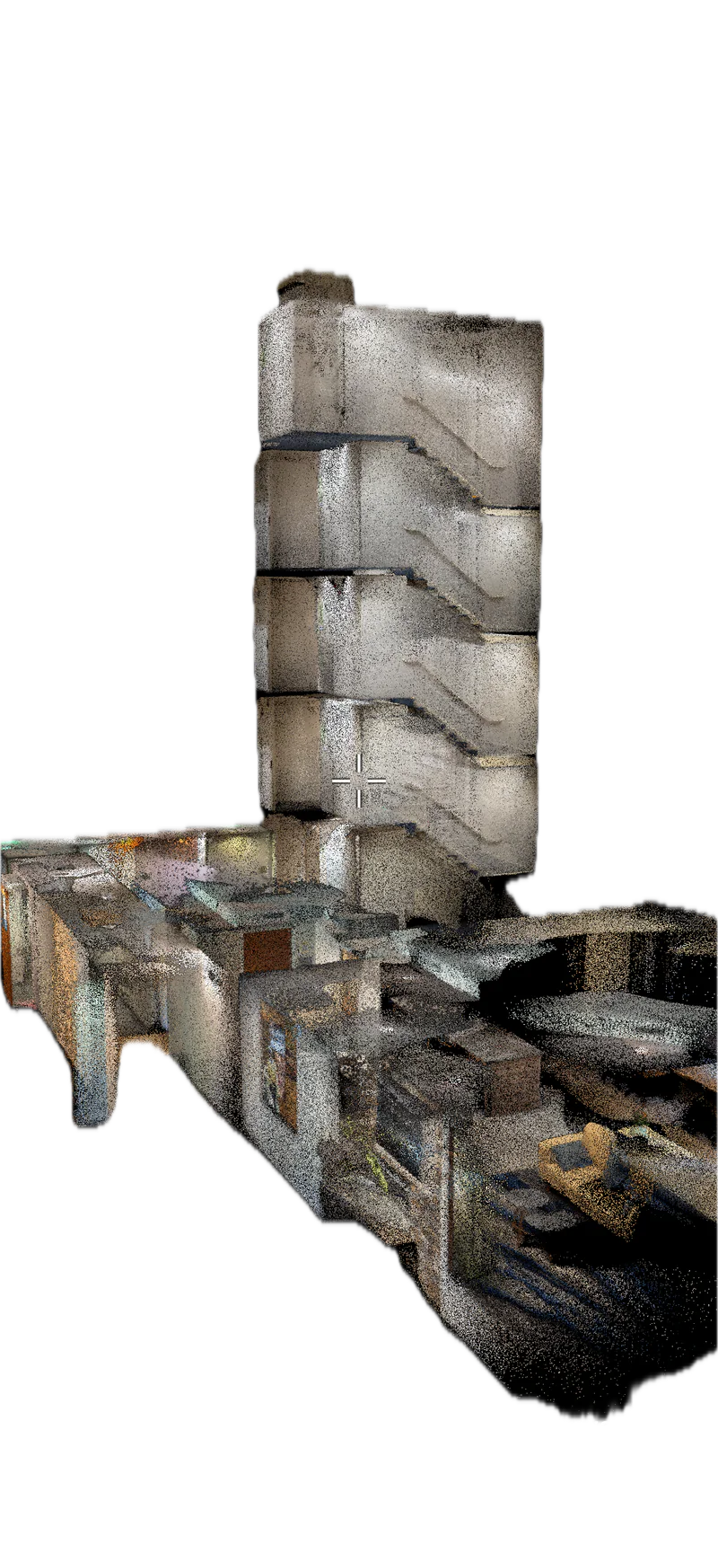
Existing-conditions deliverables get specified by LOD, the level of detail, and LOA, the level of measured accuracy. What matters is stating the LOA plainly, not printing a big number. So here it is plainly: iPhone LiDAR is centimeter-class. Room-scale captures typically land within a couple of centimeters over a normal room. That is the right accuracy band for renovation, space planning, and existing-conditions documentation, and it is not a survey-grade terrestrial scanner. We will not pretend otherwise.
Treat the scan the way you treat any field survey. Capture fast, then verify the dimensions that are code-driven or fabrication-driven, plus long runs and glass, against a tape or laser before you build design work on the import. The step that disappears is the manual measuring and re-drawing, not your judgment.
How accurate is iPhone LiDAR for as-builts?From site visit to CAD, in three steps
Capture, plan, quantify. The whole existing-conditions workflow runs from a phone.
Capture on site
Walk the building with iPhone or iPad Pro LiDAR. Millions of points at whole-home scale, captured same day. Start free; E57, IFC, and DXF exports are on Pro and Business plans.
Share and document
Send the viewer link, measure and slice in the browser, and refine the measured floor plan and schedules with assisted review.
Export to your stack
E57 into ReCap and Revit, IFC into ArchiCAD, a layered DXF underlay for AutoCAD, and a dimensioned PDF set. One geometry, every format.
Schedules generated from the plan
Room, Wall, Door, and Window schedules plus a master summary, in feet-inches or metric. Net areas deduct openings and trim, and every element is tagged to match the drawing.
Existing conditions, straight into Revit and ArchiCAD
When you need the model and not just the cloud, export IFC. The scanned building opens in Revit, ArchiCAD, or any IFC-aware tool with walls, doors, windows, rooms, and multiple stories intact. Start renovation design from an accurate as-built instead of re-modeling a building that already exists.
- IFC opens in Revit, ArchiCAD, and Navisworks
- Walls, doors, windows, rooms, and multiple stories as objects, not a mesh
- A starting model for renovation and retrofit, not another day of re-drawing
Mark up the set before handoff
Drop in photos, draw call-outs on a wall elevation, and add notes where the geometry needs context. No round-trip through a separate annotation tool.
Related use cases
See how the capture connects to the rest of the workflow
Frequently Asked Questions
How does SiteScope help architects document existing conditions?
What formats can I export for Revit, ReCap, and ArchiCAD?
How accurate is an iPhone LiDAR scan for as-builts?
Can I share the scan with a client or consultant without an account?
How does this compare to a scan-to-BIM service bureau?
Is the exported model editable, or just a mesh?
Ready to Get Started?
Scan your first room free, no credit card. Capture runs on an iPhone or iPad Pro, and everything else works in your browser.

On your computer?
Point your iPhone camera here to get the free app from the App Store. Scanning needs an iPhone or iPad Pro.