
AI floor plan generators are good at producing a quick, editable layout from a description, and at reading clean existing drawings so you do not have to trace them by hand. They cannot measure a space that already exists: a text prompt has no dimensions to work from, and a single photo does not carry reliable scale or hidden geometry. If you need a plan with real measurements, scan the space with LiDAR or trace an existing drawing at a known scale, then refine it in an editor.
Here is what each kind of AI floor plan tool does well, where it breaks, and how to pick the right starting point for the job.
The Four Things People Mean by “AI Floor Plan Generator”
The phrase covers very different tools. It helps to separate them by what goes in.
1. Text to floor plan
You type something like “three-bedroom apartment with an open kitchen,” and the AI proposes a layout.
Good for: early concepts, test fits, client conversations, and trying layouts quickly. Not good for: anything that has to match a real building. The dimensions are plausible, not measured.
2. Sketch or image to floor plan
You upload a hand sketch, a listing plan, or a screenshot, and the AI tries to turn it into walls, doors, and rooms.
Good for: turning a clean drawing into editable geometry faster than tracing every wall yourself. Where it breaks: thin or faint lines, cluttered drawings, furniture symbols read as walls, and missing scale. Output quality tracks input quality closely.
3. Blueprint or PDF digitizing
A special case of the above, for architectural drawings and PDF sets.
Good for: bringing existing plans into an editor you can quote or design from. Watch out for: drawings show design intent. The building may have been changed since, and old drawings may not match what was built.
4. Photo of a room to floor plan
You take one or a few photos of a room and expect a plan.
The honest answer: a single photo does not contain enough information for a measured plan. It has no reliable scale, it cannot see behind furniture or around corners, and the camera lens distorts straight lines. Some tools infer a rough layout from photos, and that can be useful for a sketch. It is not the same as measuring.
What AI Can Do Well
- Propose layouts from a description in seconds
- Read clean drawings and draft walls, doors, and windows so you are editing instead of tracing
- Apply edits in plain language, such as “widen this hallway” or “add a bathroom here”
- Label rooms and fill in obvious elements consistently
- Save time on the tedious parts of getting a plan into an editor
What AI Cannot Do (Yet)
- Invent dimensions it was never given. If there is no scale in the input, there is no real scale in the output.
- See what is not in the image. Walls behind furniture, closets around a corner, ceiling heights, and out-of-square corners.
- Guarantee wall thickness, opening sizes, and sill heights from a drawing that does not state them.
- Replace verification. Any plan used for ordering materials or building needs a human check.
That is not a knock on AI. It is a reminder that measurement needs a measuring source.
Where the Measurements Come From
There are only a few real sources of dimensions for a floor plan:
- A tape or laser, recorded by hand. Accurate, slow, and easy to miss a wall.
- An existing drawing with a known scale. Fast, but only as current as the drawing.
- A LiDAR scan. The sensor measures depth directly as you walk the room. On an iPhone Pro or iPad Pro, room-scale captures typically land within a couple of centimeters over a normal room.
AI can speed up the drawing work around these sources. It cannot be a fourth source by itself.
Two Approaches That Give Measured Results
Scan the room
A LiDAR room scan produces a measured plan with walls, doors, windows, and room areas automatically, because the sensor measured them. There is no prompt to write and no layout to guess. You walk the room for a few minutes and the plan is there. This is the fastest reliable way to get an as-built plan of a space you can walk into. If you are doing existing-conditions work, see the as-built workflow for architects and designers.
Trace an existing plan at a known scale
When you have a drawing, upload it as a reference layer, set the scale from one dimension you know, and trace the walls over it. Some tools offer one-shot AI conversion here; whichever way the walls get drawn, correct what is off and confirm the key dimensions. Tracing at a known scale is far more reliable than hoping a conversion got every wall right.
When Each Approach Makes Sense
| Situation | Best starting point |
|---|---|
| Concept or test fit, no building yet | A text-to-plan AI tool, or a quick sketch |
| Existing building, you can visit | LiDAR scan |
| Existing building, client can visit | Guest scan: the client installs the free SiteScope app on their iPhone Pro (no account needed) |
| Clean architectural drawing available | Trace it at a known scale, then verify |
| Rough hand sketch only | Trace it with a few key dimensions, or scan |
| Photo of a room only | Use for reference, then measure or scan |
If the client is the one on site, see how to run a remote site survey with guest scanning.
How SiteScope Gets You a Floor Plan
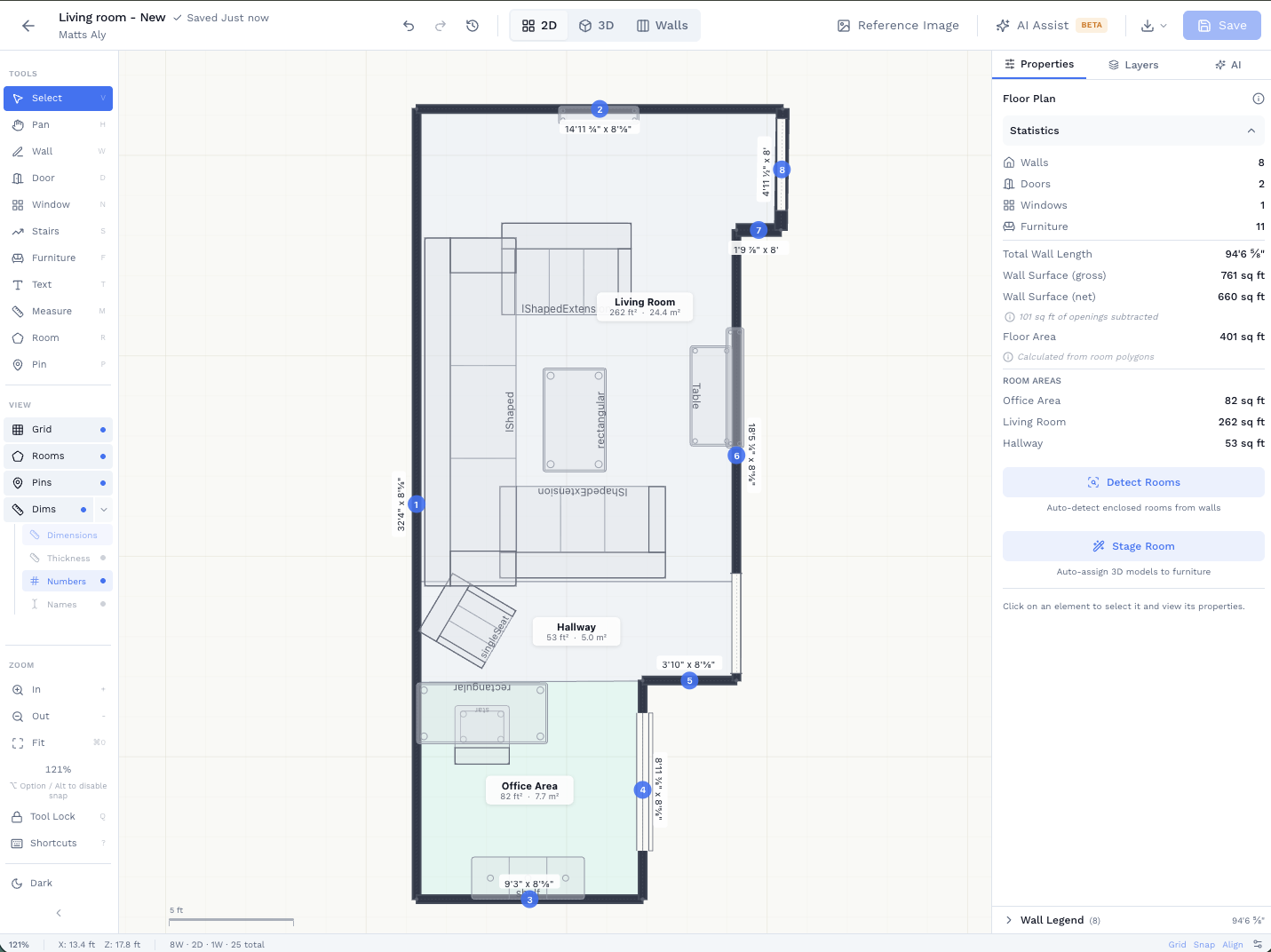
SiteScope leads with measurement. Business workspaces can start a rough plan with AI in the web app (describe a layout, or recreate one from a drawing in beta), but the everyday paths are built for real measurements, and every path ends in the same web editor:
- Scan with an iPhone Pro or iPad Pro and the measured floor plan builds itself from the LiDAR data
- Upload an existing plan, PDF, photo, or sketch as a reference layer and trace it at a scale you set
- Send the client a guest scanning link when you cannot get to the site. They install the free SiteScope app, with no account to create, and scan for you
From there, you edit walls, doors, and windows, walk the plan in 3D, and export PDF, DXF, or GLB. For trades, the same plan feeds paint, wallpaper, tile, and wall covering takeoffs. See the details on the AI floor plans page.
How to Judge Any AI Floor Plan Tool
Ask these before you rely on one:
- Where do the dimensions come from? If the answer is “the AI estimates them,” treat the plan as a sketch.
- Can you set or check the scale? A known dimension should drive the whole plan.
- Can you edit every wall, door, and window? A picture of a plan is not a plan.
- What does it export? PDF, DXF, and IFC are what the rest of your workflow reads.
- Does it show its mistakes clearly so you can fix them fast?
If you want to see the difference between a generated layout and a measured one, start for free, scan a room you know, and compare the plan with your tape. For a team setup, talk to us.
FAQ
Can AI create a floor plan from a photo?
It can infer a rough layout, but a single photo lacks reliable scale and cannot see behind furniture or around corners. For a measured plan, scan the room with LiDAR or measure it.
Are AI floor plan generators accurate?
For concepts, accuracy is not the point. For existing spaces, a plan is only as accurate as its measurement source. A LiDAR scan or a scaled drawing gives real dimensions. A text prompt does not.
Can AI convert a blueprint into an editable floor plan?
Some tools offer AI conversion as a starting point, and clean drawings convert best. Either way, set the scale from a known dimension, fix what was misread, and check key dimensions before you use it. In SiteScope you upload the blueprint as a reference layer and trace it in the web editor.
What is the most accurate way to make a floor plan of an existing room?
Measure it directly. A LiDAR scan from an iPhone Pro or iPad Pro captures walls and openings in minutes, and room-scale captures typically land within a couple of centimeters over a normal room.
Do I need an iPhone Pro to make a floor plan in SiteScope?
Only to scan. Scanning needs an iPhone Pro or iPad Pro with LiDAR. Tracing an uploaded plan and editing it happen in the web app in any browser.